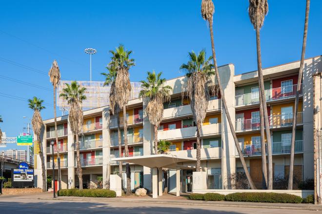
Photographs courtesy Bob Howen Photography.
Monster storm Sandy has made storm surges and sea level rise a timely topic once again. Renee Loth, editor of ArchitectureBoston, calls for better planning now. Since Hurricane Ike struck Houston, a number of proposals have been floated to protect this region. In the Spring 2011 issue, Cite covered the ongoing debate about the Ike Dike and an alternative proposal. But little action has been taken. Below, in a piece published in the current issue of Cite available now at bookstores, Galveston writer Sandy Sheehy looks at efforts to use wetlands preservation and tourism as a means to save the Texas Gulf Coast from further catastrophe.
Four days after Hurricane Ike hurtled across Galveston and charged up Interstate 45 to Houston on September 13, 2008, a team from the Army Corps of Engineers noticed something remarkable as they assessed damage by boat: water was still streaming off the Chambers County wetlands into the east arm of Galveston Bay. The flow was so substantial that it looked like a long waterfall. With the center of Ike’s 46-mile-wide eye tracking over Galveston at 73rd Street, then up the interstate, the Bolivar Peninsula, and the marshy pastureland to the north across the bay had been on the “dirty side” of the storm – the northeast quadrant. With sustained winds of 110 miles per hour, Ike ranked only as a high Category Two on the Saffir-Simpson Scale; but in terms of size (120 miles across) and kinetic energy, the storm was one of the most powerful on record. It lifted the Gulf of Mexico into Galveston Bay and Galveston Bay into San Leon, Bacliff, Kemah and, from the harbor side, the city of Galveston. Combined with the uprooted trees, downed power lines, ripped roofs, and other windstorm mayhem across Houston, this near- biblical level of flooding brought the cost of damage to $27 billion, making Ike the third most expensive hurricane to make landfall in the U.S.
The wetlands had acted like a sponge. First, they absorbed the 14-foot storm surge that had flattened up to 90 percent of the structures in towns and subdivisions on the Bolivar Peninsula, then they released it gradually back into the bay.
“That caught our attention,” says Houston environmental attorney James Blackburn, Professor of the Practice in Environmental Law at Rice University. “The key word is ‘resiliency.’ The area can absorb a storm and recover.”
Blackburn is also a co-director of the SSPEED Center---for “Severe Storm Prediction, Education and Evacuation from Disasters”---a consortium of seven universities. Based at Rice, it includes experts from the University of Houston, Texas Southern, Texas A&M, UT Austin, UT Brownsville, and LSU, plus several architecture and engineering firms. Established in 2007, SSPEED initially focused on lessons from Hurricanes Katrina and Rita; but within a year, they had Ike to learn from.
With the primary goal of protecting lives and minimizing property damage, the group studied a variety of ideas, including one developed by William J. Merrill before the SSPEED Center started its work. Inspired by the massive structures that keep the North Sea out of Holland, Merrill’s so-called Ike Dike would be a massive floodgate that could close off Bolivar Roads, the entrance from Galveston Bay to the gulf. A multibillion-dollar price tag made that approach unfeasible, at least in the present economic climate. And there were also environmental objections.
“My main concern about the Ike Dike would be the impact it would have on the environment,” cautions Alice Anne O’Donell, M.D., chairperson of the Galveston Audubon Group of the Houston Audubon Society. “It would prevent the normal, natural barriers to high waters from working.”
And periodic flooding renews the wetlands, helping maintain them as nurseries for fish,crabs, shrimp, and oysters and as lifelong habitat for birds.
“Wetlands function in two ways,” SSPEED’s co-founder and director Phil Bedient, Rice professor of environmental engineering, explains. “They’re definitely an area of storage, and they can help knock down the peaks of these surges.”
Aided by a $1.25 million two-year grant from the Houston Endowment, later renewed for an additional three years for $3.2 million, the SSPEED Center assembled its diverse coalition of experts and began exploring alternatives that would work with the natural process, rather than reining it in. They are carefully coordinating with the Port of Houston to explore constructing a gate structure at the mouth of the Houston Ship Channel.
The preservation of wetlands is the most innovative idea to come out of the center. They considered turning the storm-trampled Bolivar Peninsula into a national seashore, similar to Padre Island, then rejected the idea. It was unlikely to fly under current economic conditions, and it ran contrary to Texans’ attitudes about property rights.
Like other forms of national parks, national seashores involve the federal government’s buying up historically or scenically important real estate, often using the concept of eminent domain to leverage property from reluctant buyers. Beginning with Yellowstone in 1872 and proliferating after the National Parks Service Act of 1916, national parks have entailed the U.S. Department of the Interior owning and managing scenically or historically important real estate, creating and managing tourism infrastructure, and strictly regulating concessions for lodging, food service, canoe rentals, and the like. To keep the parks within the vacation budgets of average Americans, entrance fees are maintained at a level that doesn’t begin to cover costs. Most of the expense is borne by taxpayers whose enjoyment of the natural wonders will be limited to calendar photos and Discovery Channel documentaries, because these unspoiled natural areas often are far from major cities. (For example, Big Bend National Park is 12 hours from Houston, eight from San Antonio and even four from El Paso.)
Extending its scope to all the precious marshes in and near Galveston Bay (the country’s second-largest bay after Chesapeake) and to the barrier island and peninsulas protecting them from the open Gulf, SSPEED brought together state and federal agencies, nonprofit conservation groups, local governments and representatives of the tourist industry to explore an alternative: create a national recreation area extending from Winnie and High Island, along the Bolivar Peninsula and southwest to Matagorda Bay. Save the wetlands and let THEM protect the built environment on the mainland by offering an economic incentive to local residents: greatly increased revenue from tourists – tourists drawn by the natural assets themselves, not by elaborate, expensive resorts and golf courses. And let’s call it something that would stir Texas pride – the Lone Star Coastal National Recreation Area (LSCNRA).
As proposed in the LSCNRA, the National Park Service contributes expertise and coordination, giving nonprofit organizations, state and government entities, private property-owners, and entrepreneurs incentives to work together and defray overall costs.
Those cooperating entities also reap tremendous economic benefits from recreation and tourism activities. “It’s a recreation area, but it’s also a way for conservation to abound along the coast,” says Bedient.
Although a national recreation area is a congressionally-created unit of the National Park Service, as proposed, the recreation area’s assets will be primarily owned by private individuals and businesses, or by other government entities or nonprofits. Participation by landowners is voluntary; but if they want their fishing marina, for example, to be promoted as part of this government-sanctioned tourist destination, they must sign an agreement stipulating that certain mutually acceptable conditions will be met.
The SSPEED team recognized that political and business expertise would be essential to the project’s success. They persuaded distinguished statesman Secretary James A. Baker III to become honorary chair of the steering committee. As chair, they enlisted Houston businessman John Nau III, who with his wife, Bobbie, owns Silver Eagle Distributorship, the second-largest beer distributorship in the U.S.
Believing that business leaders have an obligation to do public service, Nau had previously focused his volunteer efforts on historic preservation, creating a business-based model for taking preserved assets, from battlefields to old forts, and translating that into “preservation for a purpose” – in other words, tourism and economic development. At the request of President George W. Bush, Nau came to the Alabama and Mississippi coast right after Katrina and witnessed the role the marshlands, estuaries, and barrier islands played in protecting areas of development.
Those experiences combined to fire his enthusiasm about the Lone Star National Coastal Recreation Area. “It combines the economic benefits of tourism and the ecological benefits of marshland,” Nau explains, “and it focuses the attention of local residents on these assets. On top of that it’s 100 percent voluntary, which is how Texans view their land. That’s absolutely the sweet spot.”
One advantage to the national recreation area approach is that for more than three decades it’s been shown to work. The U.S. now has 18, with one of the oldest, Santa Monica Mountains National Recreation Area, abutting Los Angeles. LSNCRA task force member Lynn Scarlett, who was Deputy Secretary of the Interior under President George W. Bush, considers Boston Harbor Islands National Recreation Area a good model for the Upper Texas Coast, partly because of its combination of natural and historical assets. Established in 1996, Boston Harbor Islands NRA incorporates 34 islands and peninsulas, lighthouses dating to the 18th century and a Civil War-era prison.
“The creation of a national recreation area provided some glue and coordination, along with some federal money and considerable technical expertise from the National Park Service, which knows so much about interpreting this nation’s history and natural environment,” Scarlett explains. For example, Outward Bound is a non-profit that owns land on Thompson Island in Boston Harbor. Their ability to provide outdoor experiences for youth is greatly enhanced by the gateway visitor’s center, maps, brochures, and the more regular ferry service brought about under the national recreation area. The non-profit, however, retains control over who has access to its land. Another island features a historic fort and others public beaches. As Scarlett says, “The recreation area takes disparate parts and provides the glue for a greater whole.”
The proposed LSNCRA is proposed to incorporate sizable portions of Chambers, Galveston, Brazoria and Matagorda counties, which have more than 350,000 acres of bays and estuaries. Partners might include the Anahuac and Brazoria National Wildlife Refuges and the 5,000-member Houston Audubon Society with its 2400 acres of sanctuaries. Between March and May 2011 HAS sanctuaries at High Island and on the Bolivar shore drew 12,000 visitors representing 47 states and 15 foreign countries.
These are the kind of tourists any region would want. As Diane Olsen, president of the Galveston Island Nature Tourism Council, puts it: “Nature tourists are a different breed. They prefer things that are undisturbed. They’re more considerate of their surroundings. And they certainly have the money to spend.”
Visitors would access the LSNCRA through three highways leading off Interstate 10– US 288, I-45 and SH 124 – utilizing accommodations, restaurants, and similar services in Freeport, Galveston, High Island and along the Bolivar Peninsula. A lot of the infrastructure is in place, at least for the start. Raised walkways, docks for kayak rentals and guide services, and rustic eco-lodges would be constructed with future hurricanes in mind. “The buildings and other structures would be elevated,” Bedient says. “If they were taken out by a storm hit, it wouldn’t be taking out entire subdivisions.”
In February the task force released a report predicting that by its tenth year of operation the Lone Star National Coastal Recreation Area would add 5,260 new jobs to the region, including 11 percent more in tourism, and would infuse $192 million into the local economy. That money will come from the pockets of an additional 1.5 million visitors. Wouldn’t that many people threaten the wetlands ecosystem the program intends to save?
“Alaska has already seen changes due to increased tourism,” concedes Gina Donovan, executive director of the Houston Audubon Society. “But I’d rather have the opportunity to connect people with nature. Due to urban sprawl, the area is going to be affected. If it’s going to be impacted negatively, I’d rather have it be by people enjoying it.”
The project is being pursued in collaboration with the National Parks Conservation Association and Houston Wilderness. Along the coast, response to the proposed Lone Star National Coastal Recreation Area has ranged from cautiously positive to exuberant. Bob Stokes, president of the Galveston Bay Foundation, calls it “a promising opportunity,” but adds “a lot of pieces have to come together to make it work from a conservation perspective.”
Some of those pieces were discussed at the SSPEED Center’s conference “Gulf Coast Hurricanes: Mitigation and Response” on the Rice University campus on April 10-11. A highlight of the meeting will be the release of Philip Bedient’s new book, Lessons from Hurricane Ike (Texas A&M Press). Ultimately, the U.S. Congress must approve Lone Star National Coastal Recreation Area. The conference was one step in the SSPEED Center’s development of the background documentation for review by the National Park Service.


