Rendering from the University of Michigan proposal for the current site of the downtown post office
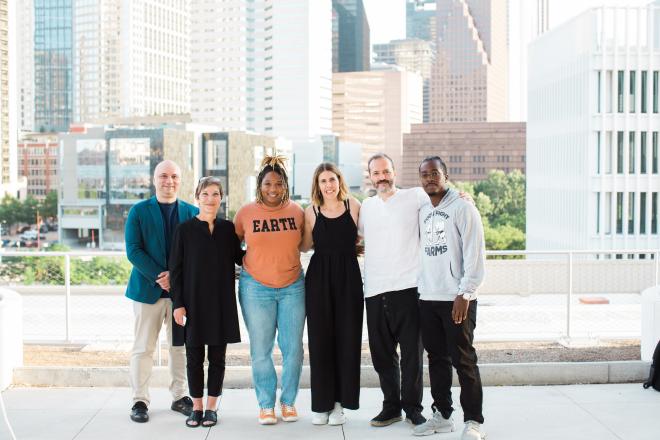
On April 6 the four finalists of the 2012 Urban Land Institute (ULI)/Gerald D. Hines Student Urban Design Competition presented their designs in the hopes of winning the $50,000 grand prize. Selected from a group of 140 entries, they were flown to Houston to tour the site on March 9 and were given a final two weeks to refine their proposals. The project this year was to re-plan a 16.3-acre site that currently houses Houston’s central post office and mail processing center at 401 Franklin Street on the northern edge of downtown, and which government officials have discussed selling. Probably because this was the tenth anniversary of the competition, which was endowed by Hines, the site was located in Houston where the company began. Gerald Hines himself was in town to watch the presentations.
The ULI is a professional organization for real estate developers that functions as something analogous to the American Institute of Architects. Its members advocate for the good design of shopping centers, subdivisions, and apartment complexes across the country. One of its major honor awards is the Urban Land Institute J.C. Nichols Prize for Visionaries in Urban Development, which is named after the developer of Kansas City’s famed County Club District, begun in the 1910s. (Nichols’s work directly influenced the development of River Oaks in Houston, Highland Park in Dallas, and Beverly Hills in Los Angeles among other posh real estate ventures.)

Site of the 2012 competition
The selection of sites for the urban design competition gives an indication of the interests and agenda of the ULI. Of the previous nine competitions, which always assume that an imaginary, but benevolent developer is planning a large project in a medium to large American city, eight have been located on liminal sites directly adjacent (or very close) to a historic downtown commercial center. The only variation from this pattern was the 2005 competition where teams chose between two very large 2,000-acre sites, both located in the suburbs of Salt Lake City. The requirements generally call for an ecologically sensitive, LEED-rated, pedestrian-oriented, mixed-use development with strong connections to public transportation, although they still require adequate parking for those recalcitrant folks who refuse to give up their cars. To my mind this criteria and general focus on the densest parts of the city begins to recall Charles Moore’s mild admonishment from his 1967 essay “Plug It in, Rameses, and See if it Lights Up, Because We Aren’t Going to Keep It Unless It Works”:
It is curious to note with what consistency architects, and especially architecture students, continue to fly in the face of all the available facts, with the breathless announcement that the only problem worth their consideration is the super-high density pedestrian urban core of the sort which continues to exist in New York, Calcutta, Provincetown, Carmel, and a diminishing list of other places.
Although I agree with Moore in that the looming problem in most American cities is the manifestly unsustainable, low density spread of their peripheries, the solution is most likely going to have to be legislative, not architectural, as those familiar with the National Housing Act of 1934 and the Federal-Aid Highway Act of 1956, which are the godparents of urban sprawl, can attest. That said, these inner city sites, mostly falling in the shadows of downtown office towers are not without interest.

Bird's eye view of the 2012 competitions site
Despite the fact that almost half of the respondents to Stephen Klineberg’s Houston Area Survey since 2010 said that they would prefer “a smaller home in a more urbanized area, within walking distance of shops and workplaces,” neither private real estate developers nor the the city seems able or interested in accommodating that desire. In fact, the city of Houston has a bad experience with similar situation fairly recently. In the 1990s it gave considerable public funds to the non-profit group, Houston Renaissance, Inc., to buy run-down, but inhabited properties in the Fourth Ward (also known as Freedman’s Town), a national historic district directly adjacent to the western edge of downtown and then rehabilitate them for low-cost housing. Instead, however, Houston Renaissance sold the properties they bought at low prices to townhouse developers. Nearly all the old shotgun houses were replaced with gated three-story townhouses. A neighborhood of porches became one of gates and garage doors. Perhaps things might go better with the post office site.
Although the competition brief is no longer posted on the ULI website and was not available on request, there seems to have been at least one rather serious omission. When I toured the site with the students, none of them seemed to know anything about the existing post office building---the architect, landscape architect, or date of construction (but neither did the custodian of the building who gave the tour for that matter). According to a ULI representative, the participants were told the building and plaza were of historical significance. However, that information seems to have been lost at some point in the process. Three of the four teams proposed the demolition of the building, which to me is worrisome. And I thought it was Houstonians who are supposed to care little for architectural preservation! During the site tour I tried to explain the architectural significance of the building and plaza. One of the teams reworked their scheme to include part of the post office building. And a few days after I mentioned this to my colleague, preservationist Anna Mod, who replied:
The National Historic Preservation Act of 1966 applies to federally owned, funded or permitted projects. The post office building and site downtown is federally owned, thus any redevelopment must comply with this law. The building and plaza, completed in 1962, are now fifty years old and eligible for listing in the National Register of Historic Places as a good example of mid-rise federal architectural styles of the early 1960s and an example of the work of the Houston-based architectural firm Wilson, Morris, Crain & Anderson and landscape architect Fred Buxton & Associates.
Due to the NHPA, it is unlikely that the USPS will be able to sell the site without preservation covenants that protect the building and associated plaza (both the landscape and hardscape). It is unfortunate that the guidelines of the charrette did not put forth this important piece of information so that more of the teams could focus on site redevelopment that included the building and plaza.
What then, did the students propose? (Since I am not involved in real estate, I don’t believe I am qualified to discuss the financial aspect of the projects and will therefore only describe them from a formal point of view.)

Harvard GSD and Colorado Leeds School of Business proposal masterplan, Bayou Commons

Harvard and Colorado proposal aerial view

University of California Berkeley proposal masterplan

Berkeley aerial

University of Michigan proposal masterplan

University of Michigan rendering
The combined team from the Harvard Graduate School of Design and the University of Colorado Leeds School of Business went first and presented “Bayou Commons.” In their project the Smith Street bridge over Buffalo Bayou is restricted to pedestrian use and once on the other side is extends into the site and becomes its central north-south axis. This two block stretch is renamed Live Oak Row and is lined with shops and restaurants. It ends at a small park, “North Commons Park” that abuts the I-10 Freeway directly to its north. Franklin Street is pulled back and is made to curve along the banks of Buffalo Bayou to provide a wider park space along the waterfront. Washington Avenue is extended straight through the site where it dead ends in front of Bayou Commons’s monument, a torqued condominium tower that appears to be about twenty or thirty stories tall.
The second team was from the University of California, Berkeley with the “Station.” In this project, Smith Street again becomes a pedestrian bridge and empties into a large park called “The Glade.” This park, which seems to encompass maybe a quarter or a third of the site runs the along Buffalo Bayou. The ground plane of the Glade is excavated so that it slopes gently to the water and what remains of Franklin Street is converted into a raised pedestrian walkway that gives views to downtown. Washington Avenue extends through the site and jogs down to connect to Franklin Street on the south side of Buffalo Bayou. It becomes the Station’s signature shopping and dining row. As with the Bayou Commons, a tall and torqued condominium tower at the south east corner of the site provides its architectural monument. To me the Glade seemed overly large, and would require with a whole of programming to make sense. Then, unfortunately, it would have to compete with the recently completed Market Place Square park just a few blocks away as well as with Houston’s premier downtown park space, Discovery Green.
The team from the University of Michigan presented third and gave us the “Hill.” In this proposal, Smith Street again becomes a pedestrian way, this time branded the “Houston Highline” and extended north through the length of the site. As with Bayou Commons, Franklin Street is curved along Buffalo Bayou, to allow for a wider park space. Washington Avenue is extended to the east, and it curves to echo the profile that Franklin Street was given. A series of short, straight north-south streets are arrayed from east to west across the site to make about a dozen small, wavy blocks. This elicited what was definitely the “Oh no you didn’t” quote of the day from one of the jurors who prefaced a question to the group, composed of four women and one man, with, “The stream type grid is obviously the product of the female dominated team.” The northern third of the site was given to playing fields, which the team suggested could be converted to building should the need arise. Again, the monument of the site was a tall hotel on its eastern flank facing the University of Houston downtown campus. This team also incorporated what appears to be half of the post office administrative building into their revised proposal.

Columbia University proposal masterplan

Columbia University proposal aerial

Harvard and University of Colorado's Bayou Commons rendering
The final project was the “Post” by Columbia University. In what seems to be a pattern, Smith Street becomes a pedestrian bridge and extends north into the site. Franklin Street remains as it is. Washington Street extends straight to the eastern edge of the site where it dead ends into a condominium building, this time only about ten to fifteen stories tall. A third east-west street was added, called “Center Street” that runs parallel to the existing railroad track behind the post office mail processing building. The major plan change that separated the Post from the other projects was the insertion of a diagonal street, “Post Boulevard,” that connected to Franklin Street on the southeast corner of the site and dead ended into a small transit center building on the northwest corner. The Columbia team kept the administrative building of the post office, but then oddly covered it almost completely with a screen that wrapped over the both long sides and the roof. Also, Although I definitely thought they had that coolest looking buildings, I didn’t really like that they seemed like pavilions floating in space, rather than following the outlines of the street blocks more closely. In their perspective views there appeared to be very wide spaces between the irregularly shaped and multicolored buildings that brought to mind the similarly vast spaces of many of Le Corbusier’s urban projects. I kept thinking of Philip Johnson’s memorable quote in the book, The Heart of the City that accompanied the proceedings of CIAM’s eighth meeting in 1952 where he said that the most compelling urban spaces are those where there “is a feeling of being cuddled.” I didn’t get the sense that I would feel that in the Post.
Of all the projects, I thought University of Michigan's "Hill" seemed to have the most potential. I appreciated the additional streets and the smallish blocks they created. It seemed to provide the most flexibility should the developer change his mind about phasing, decide to invite other partners, or suffer some financial calamity that would otherwise affect construction. When I compared a map of Houston from 1895 showing how the streets were originally laid out on the site, the plan of the Hill was the closest match. However, the way Washington Avenue curved in addition to Franklin seemed kind of gratuitous and would have required many of the buildings to have curving elevations, which might add to their construction cost. (This is to say nothing of the torqued condominium towers that seemed to be almost a cliché in several of the other proposals.)
I think, in general, most of the projects, as well as the honorable mentions that were posted on the ULI website, suffered from too much open space. The longer I live in Houston the more I think that there is just way too much space, and just like there is too much fat in our bodies, we need to find a way to start ridding ourselves of it so we and our city can take on a more seductive form. Even if half the empty space inside the 610 Loop, for example, were filled it, the city would still seem like a garden suburb compared to most major cities throughout the world. Not that a garden city is necessarily a bad thing, just ask Lewis Mumford or Stein Eiler Rasmussen, but at least in the shadow of downtown, it would be nice to see blocks of buildings defining corridor streets, like in a “real” city.
Jane Jacobs, a great critic of urban life and one of my heroes ever since I read The Death and Life of Great American Cities (1961), was remarkably prescient. She preached for “diversity” and “organized complexity” in the urban environment, “eyes on the street” for safety, the value of old buildings, and the necessity for small blocks decades before the they were taken up by current planners. She cautioned provocatively that, “In orthodox city planning neighborhood open spaces are venerated in an amazingly uncritical fashion, much as savages venerate magical fetishes…But people do not use city open space just because it is there and because city planners and designers wish they would.”
Taking this into consideration I would have liked to see a narrow park along the bayou, and maybe a pedestrian bridge that would have connected to the large grassy lawn on the south bank to the site and thus quickly gained some open space (if you just have to have it) without losing acreage on the site. The narrow, yet splendidly laid out parks that run along Buffalo Bayou and thread through the columns that support the I-45 freeway just west of the site recently designed by SWA show how little space is actually needed to create a civic amenity. Then there could have been more streets and blocks laid out for buildings with perhaps a smaller interior park where one could feel property cuddled.
And, in case you were wondering, "Bayou Commons" by Harvard Graduate School of Design and the University of Colorado Leeds School of Business won the competition.
Ben Koush is an architect based in Houston.


