

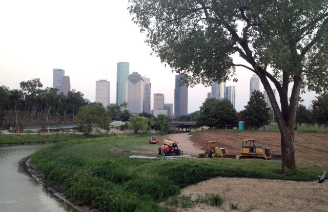
"Infrastructure is our ecosystem," Karrie Jacobs told an audience at The MFA,H, when she was in town for the Lawndale Design Fair last month. "Cities are our habitat, and manmade structures are our geologic features." And she wanted to know what might be a "natural" place for human beings in this unnatural twenty-first century. Houston, where these paradoxical proclamations ring especially true, just might be it. Jacobs, one of the founders of Dwell and a writer at Architect, used as an example of the way cities are turning blight into beauty what the SWA Group and the Buffalo Bayou Partnership are up to between Shepherd Drive and Sabine Street. Jacobs describes Buffalo Bayou as having been, for decades, a "trash-lined eyesore" and "dumping ground." Now, "a profound act of vision, optimism, and imagination," she says, has turned it into "a beloved conduit for bikers and pedestrians."
But it's that word --- "conduit" --- that's worth thinking about. Is the new Buffalo Bayou Park just a way to get people from one place to another? Jacobs talked about the park alongside the High Line in New York City, though the juxtaposition happened to emphasize one of the important differences between them: connectivity. The High Line is not an escape from the city. It's inside the city, of the city. Nine access points are spaced out across the line, four of which have elevators up. "The success of the High Line as an aesthetic object and economic magnet hasn't been lost on the developers," she says. Some of the pricey highrises that have been built because of the High Line brag about providing direct access to it; it's become a selling point. The subway has even stretched to that side of Manhattan, too.
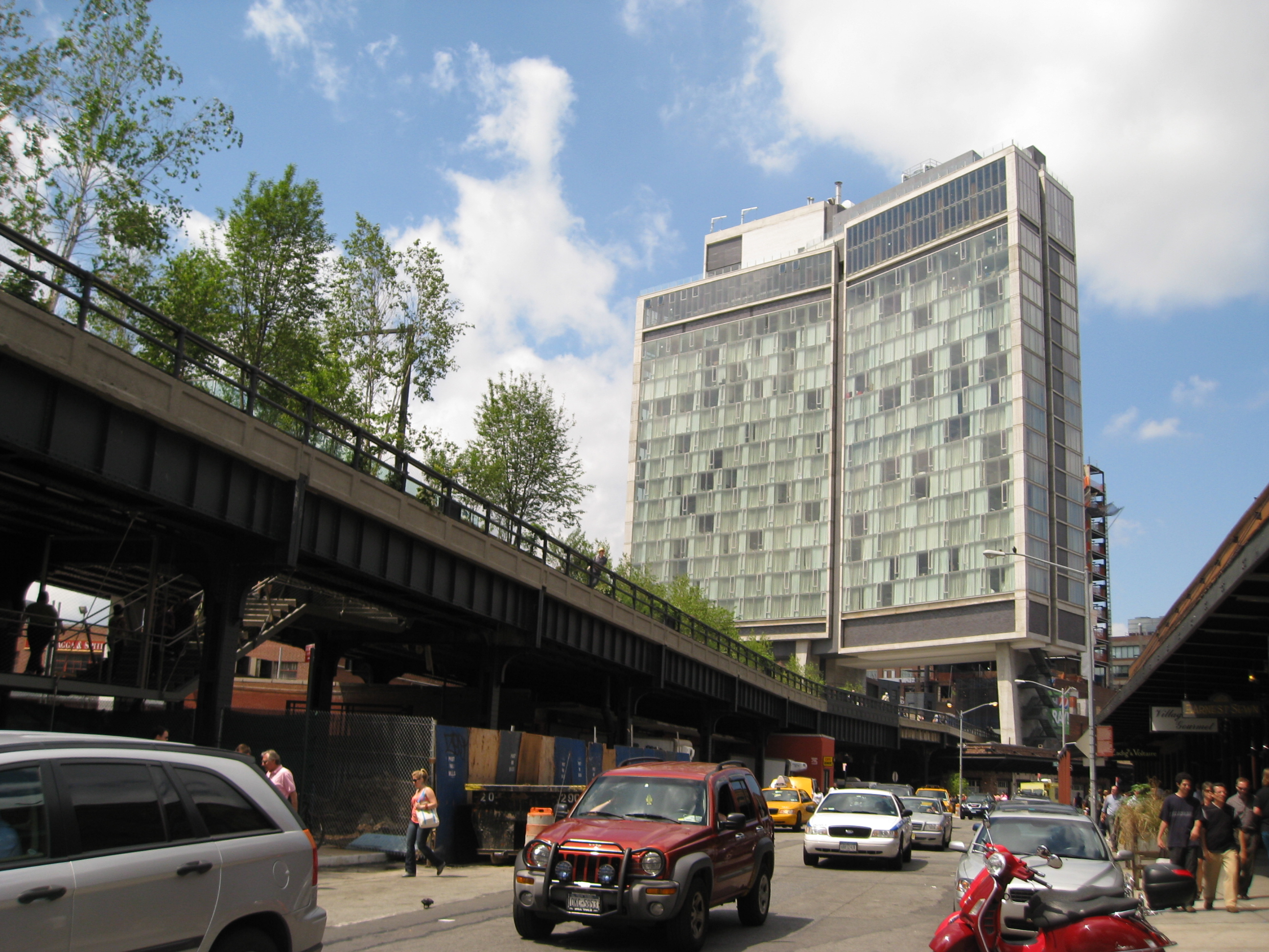 The High Line. Photo: Wikimedia Commons.
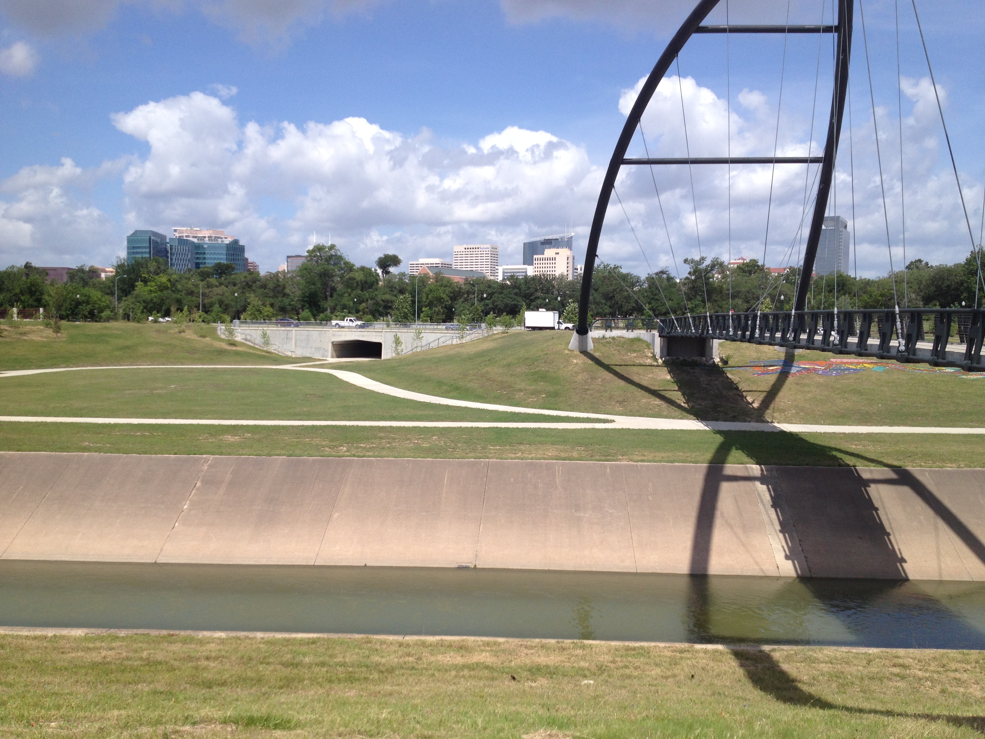
So far, that's not the case with Buffalo Bayou Park. The park, about 3 miles long, has become a kind of specialized green treadmill. Unless you happen to be able to afford to live near the two Memorial Drive-spanning pedestrian bridges in Magnolia Grove or Memorial Heights, you have to drive there to get on and use it. You fight traffic to fight again for a parking spot, get out of your car, run your loop, Instagram your photo, and drive home. It's a 24 Hour Fitness without a roof. It's not easy to get to, says the Houston Chronicle: "Crossing Allen Parkway is a real-life game of Frogger, with no extra lives. Improvements to crosswalks at Montrose and Waugh have made those access points slightly less terrifying, though the beautiful pedestrian bridges . . . are few and far between."
While she was in Houston, Jacobs experienced the frustration of this lack of connectivity. She was looking for a place for her morning jog. A concierge at Hotel ZaZa told her that the track around Rice University was a popular spot. But navigating on foot that splashy elliptical roundabout encircling the Mecom Fountain where Main, Fannin, and Montrose become entangled wasn't so simple. Worse, Jacobs says, there weren't any other pedestrians whom she could imitate.
Members of the Hermann Park Conservancy fought hard to build a tunnel a few miles away from where Jacobs struggled to cross the street. The tunnel goes underneath MacGregor Drive near the Bill Coats Bridge, connecting the trails on Brays Bayou and providing users a safe way in and out. In 2012, the Houston Chronicle reported, "Before the bridge's construction, the large parcel of prairie and woodlands could be reached from Almeda [Road], but had no direct connection to the main area of the park. [HPC executive director Doreen] Stoller said the bridge will provide easy access for people living on the park's rapidly developing east side."
 Bill Coats Bridge and pedestrian tunnel in Hermann Park. Photo: Allyn West.
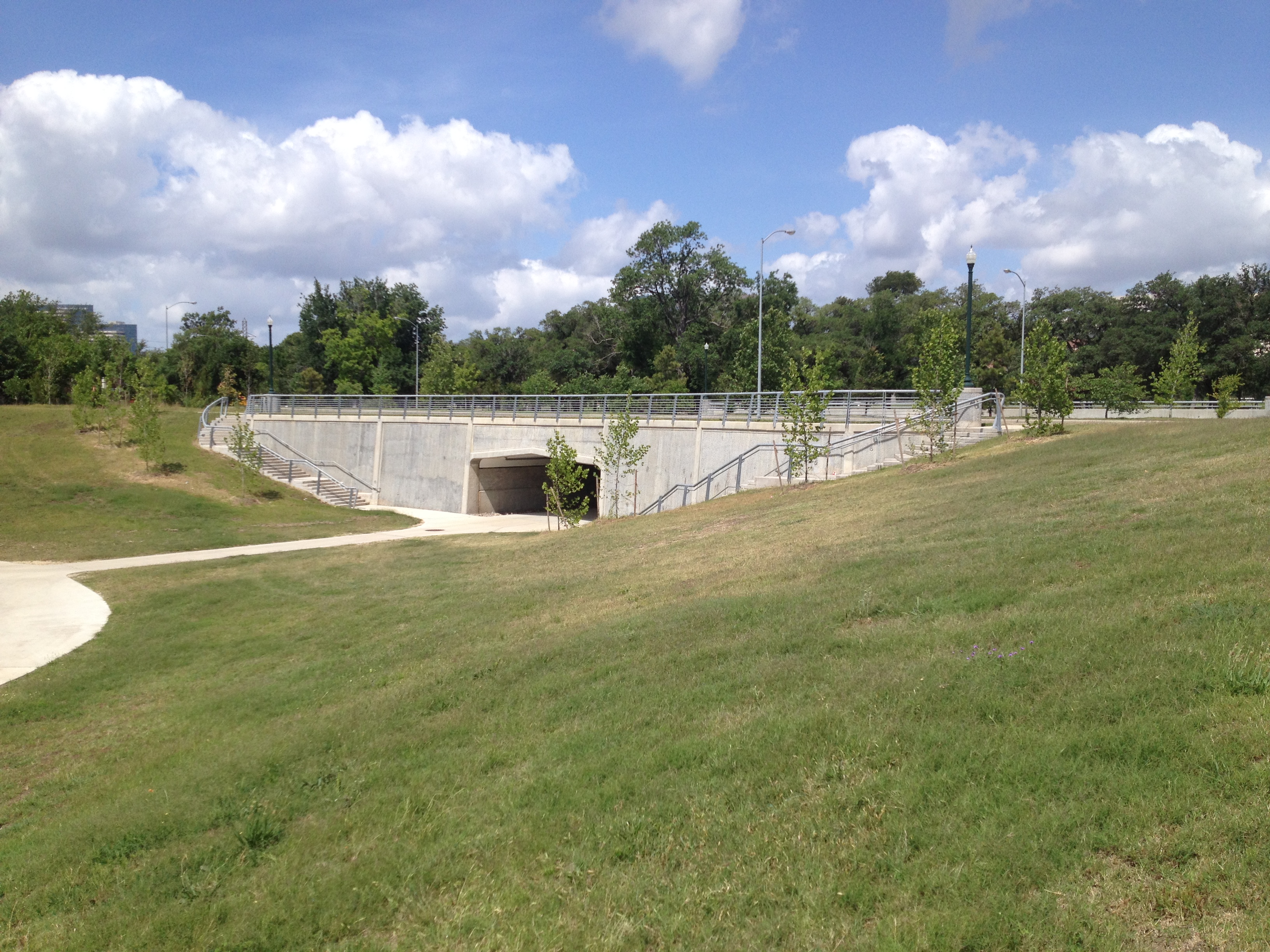 Pedestrian tunnel in Hermann Park. Photo: Allyn West.
That's a way of saying that it doesn't take much --- a tunnel here, a bridge there --- to connect what's disconnected. Though our polynuclear city, developed in fits and starts, resists it, it's worth thinking about how we can link all our "conduits" and create a network. We're spending a lot of money on the very projects Jacobs praises. We're spending a lot of money building 150 miles of Bayou Greenways, but we're not spending very much on ways to get people safely and conveniently to them. Last year, the Rice Design Alliance, which publishes this blog, gave a grant to Rice professor Gordon Wittenberg to study the use of railroad, pipeline, and utility easements as "linear parks," which could provide crucial north-south links to the greenways. Susan Rogers, who chairs the Cite editorial committee, works with her students at the University of Houston Community Design Resource Center to integrate drainage ditches and other infrastructural necessities into neighborhoods. Encouragingly, Anne Olson, the Buffalo Bayou Partnership president, told the Chronicle last year that Allen Parkway crosswalks at Dunlavy or Taft or Gillette are being considered. That would be a start, but much more than that is needed.
More >>>
Read Raj Mankad on utility corridors as bike trails.


