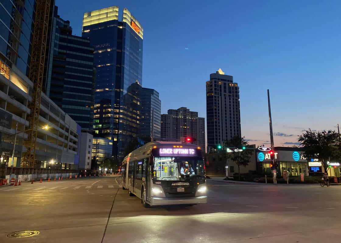
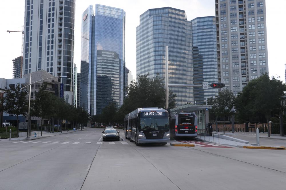
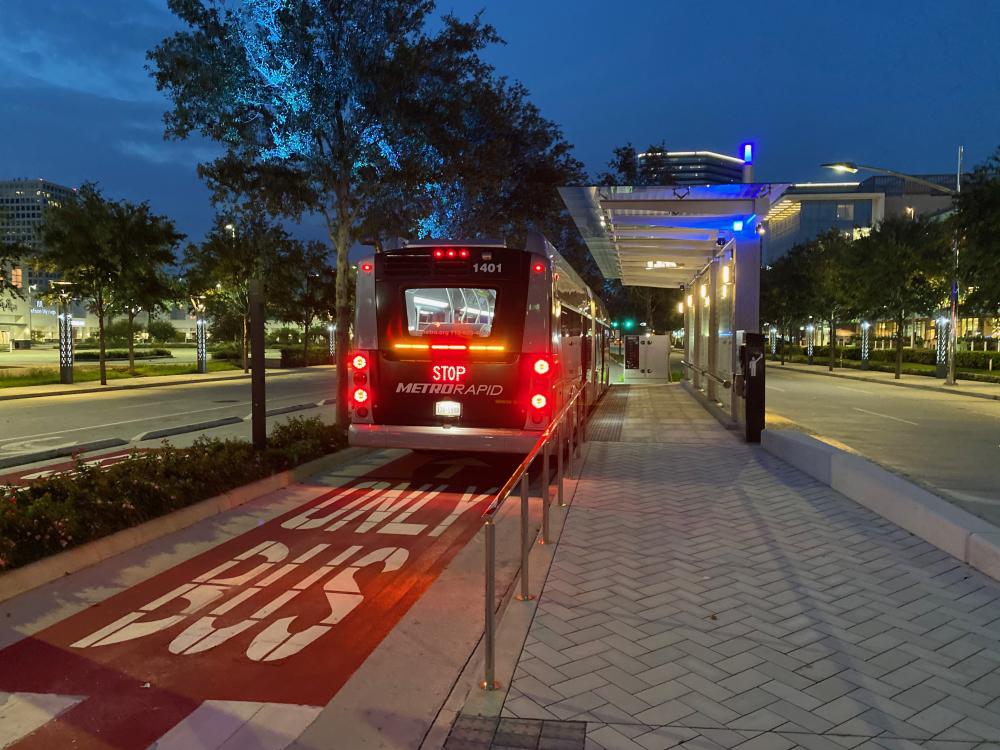
In August, the METRORapid Silver Line bus rapid transit opened in Uptown.
This is Houston’s first bus rapid transit (BRT) line—or is it? I’ll clarify later. This achievement suggests it’s something novel, but is that actually the case?
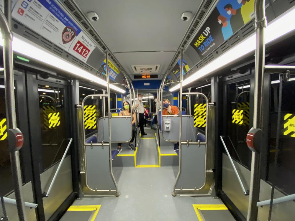
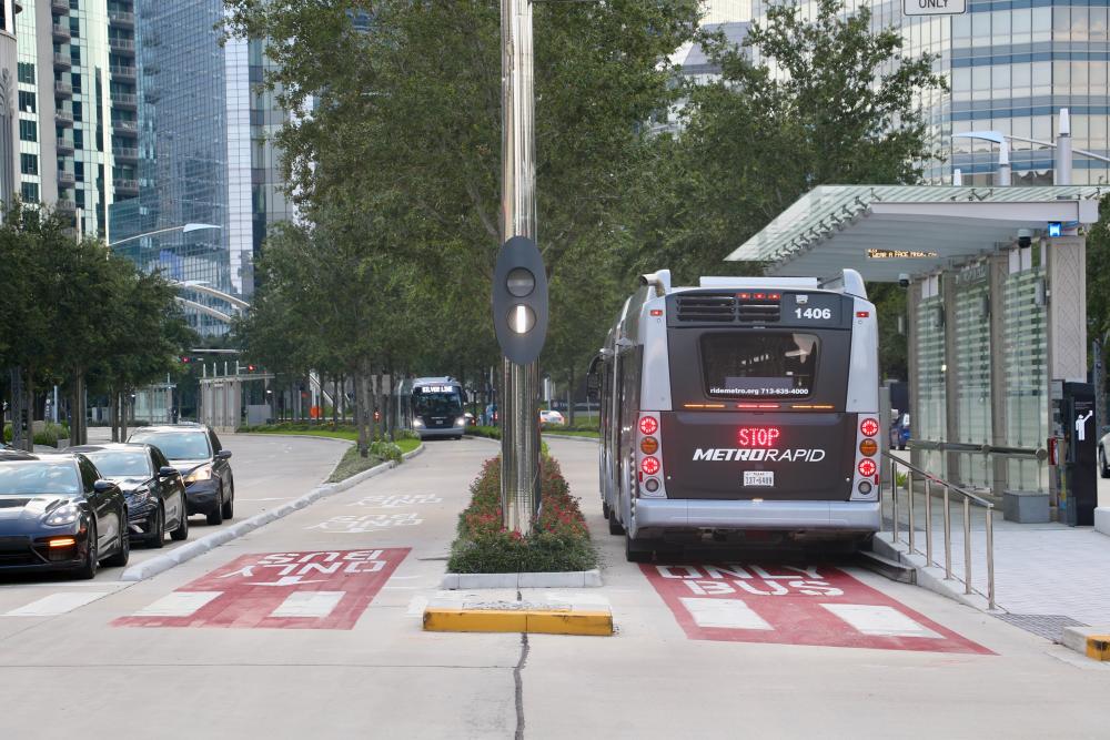
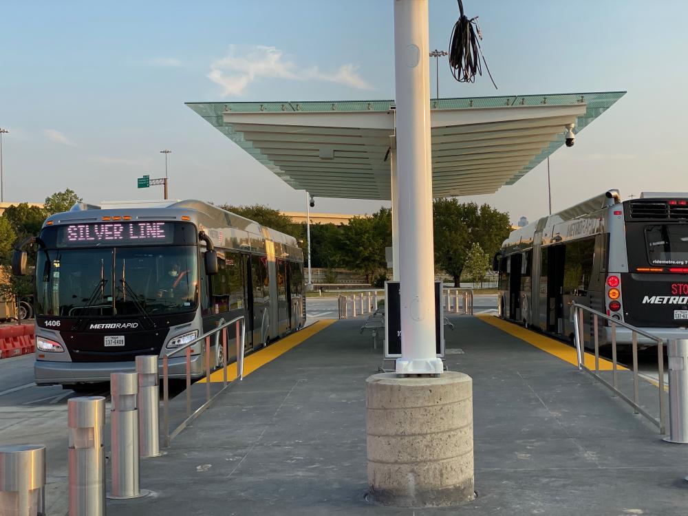
Right now on Post Oak Boulevard, you can take a crosswalk to a platform in the middle of the street. Here, you buy a ticket from a machine—or scan your Q card—and wait under a large canopy. When the electronic display announces the next northbound, you get up, watch it pull in, wait for the doors to open, and walk right from the platform onto a bus whose floor is at the same level, with space for wheelchair and bikes. You sit down—or hold on—and you and your fellow passenger—masked, as is required these days—glide down dedicated lanes controlled with special traffic signals, stop at a few more stations—their names announced as your approach—until you arrive at the transit center. Then you exit and transfer to a local bus.
This experience is a great transit experience. But it’s not new—you’ve been able to do the same thing on Main Street since 2004! The only difference is you are now rolling along on rubber tires in a concrete lane rather than on steel wheels atop steel rails.
The true novelty isn’t BRT: It’s having reliable transit next to the Galleria. We’ve had transit to Uptown for decades, including the busiest bus route in Texas. But it has always mixed in with cars in the most congested place in Houston. Now we have an option that isn’t—it’s literally the least delay-prone way there is of getting somewhere.
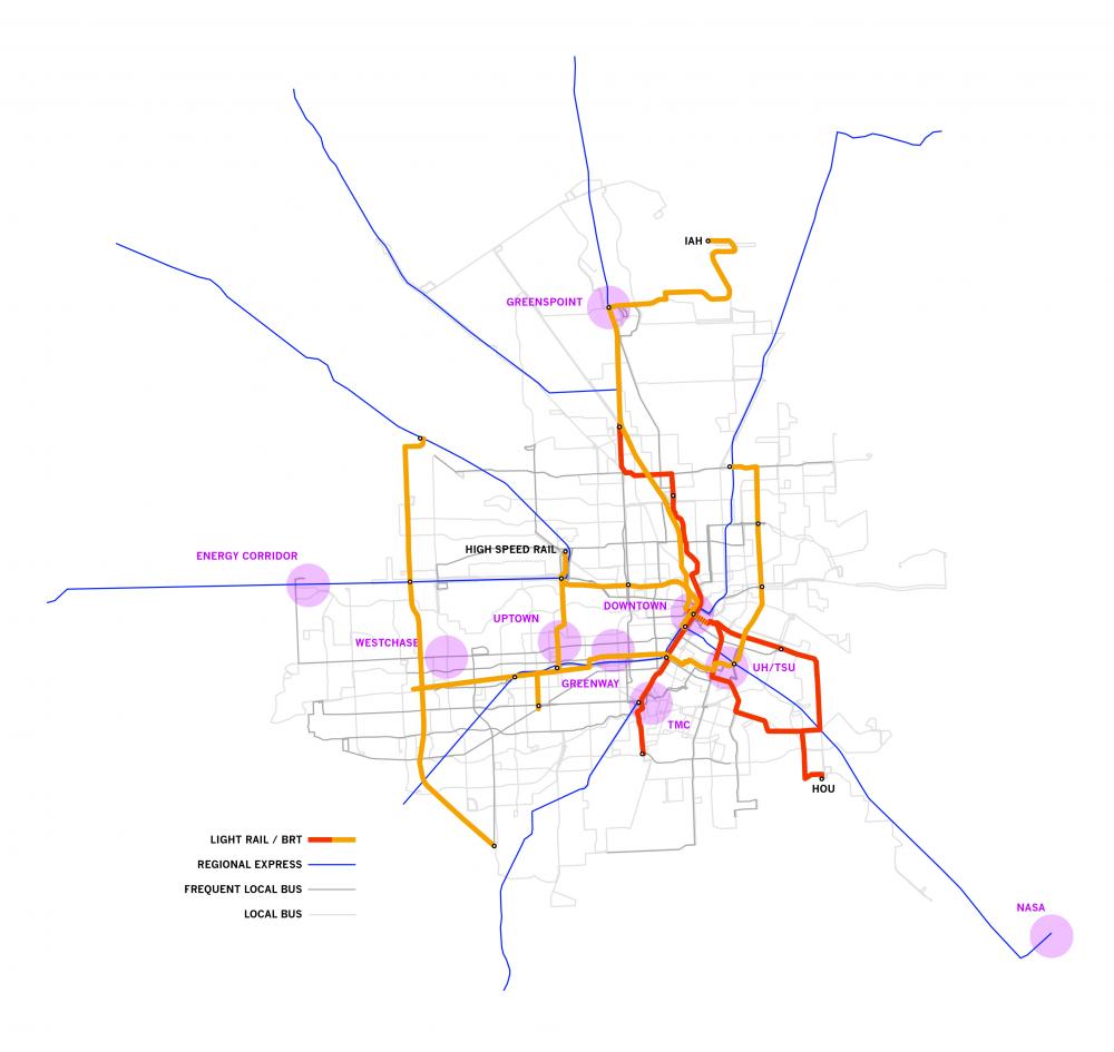
Houston has multiple major activity centers: Downtown, the TMC, Greenway, and Uptown are all among the top fifty US downtowns, and Greenspoint, UH/TSU, Westchase, and the Energy Corridor are major centers as well. Houston’s transit system evolved through connecting activity centers. Through the 1990s, Houston’s transit investments focused on building Park-and-Ride service to Downtown. That created one of the best commuter transit systems in the country: Frequent rush hour service ran directly from suburban parking lots along HOV lanes separated from freeway traffic and stopped right in front of downtown high-rises. In the 2000s, light rail connected Downtown to the TMC and UH/TSU. Now Uptown has high quality transit too. The Silver Line connects to seventeen local bus routes. It also connects to the Park-And-Rides on both ends. Buses on US290, IH10, and IH69 stop at these terminal stations and let riders transfer to the Silver Line to reach Uptown destinations.
But obviously the system isn’t complete. There’s a glaring gap, five miles wide, between the Silver Line and the Red Line. Greenway Plaza, Westchase, Greenspoint, and the Energy Corridor remain unconnected. That’s where the METRONext Plan comes in. It will make these connections by first by extending the Silver Line to Downtown, likely along IH10, a project that will start planning and design soon. Then METRO will realize a new BRT on the University Line—starting in Westchase, connecting to the south end of the Silver Line, then through Greenway Plaza, across the Red Line in Midtown, to UH/TSU, and on to the East End and Kashmere—in addition to a line from Downtown to Greenspoint and IAH, the West Houston Line from Southwest Houston through Westchase and the Energy Corridor to Northwest Houston, an extension of the Red Line, and extensions of the two existing lines to Hobby Airport. These connections are the key to our future transit system. Together they’ll create a series of high-capacity spines that will connect the major activity centers to neighborhoods, local bus service, and an upgraded version of the park-and-ride network.
Getting these spines right—both as rail and BRT—will be the key to creating an effective transit system. Good transit goes to the right places, connects to other transit, and provides frequent fast and reliable service.
These connections are the goals; bus rapid transit is a tool for creating them.
But if we’re going to use a tool, we have to figure out what it is. The Federal Transit Administration’s definition of BRT is:
Bus rapid transit (BRT) is a high-quality bus-based transit system that delivers fast and efficient service that may include dedicated lanes, busways, traffic signal priority, off-board fare collection, elevated platforms and enhanced stations.
Within that definition, there exists a vast variety of uses. In Boston, BRT includes buses running in underground tunnels and stopping at subway stations. In Pittsburgh and Hartford, buses run in bus-only roadways that follow railroad corridors, going under or over cross streets. In Cleveland, Eugene, Richmond, and Orlando, buses run in their own lanes in city streets, clearly separated from traffic. In Denver and Boulder, buses run in highway HOV lanes. In all these cases, the same buses also leave those busways and run on regular city streets. And in some “bus rapid transit” systems, the buses don’t have dedicated lanes at all. Some cities use curbside lanes that have bus priority but are also used by cars making right times. Sometimes “BRT” is nothing more than fancy paint schemes on buses and nicer-than-usual stations. The Silver Line may be Houston’s second BRT line, following the Quickline on Bellaire, whose branded bus and stops match what some cities call BRT. Or it may be the third when we consider that the Park-and-Ride buses, while not branded, operate most of their routes in HOV lanes.
So, what does this BRT toolbox offer Houston?
On streets like Richmond and Elgin, BRT could work much like it does on Post Oak, with dedicated lanes and stations in the middle of the street. This is perhaps the Silver Line’s most remarkable achievement: One of the city’s widest streets has become a much more pleasant place to be, thanks to a complete redesign by Terrain Studio, Stantec, and Mike Doyle Architecture (with early work by Design Workshop.) The stainless steel arches are still there, but everything below is different. The sidewalks have closely spaced trees and pedestrian-scaled lights. The bus lanes are lined with trees also. The landscaping breaks up the visual expanse of the street and, at the wide crosswalks, the medians provide safe refuges for pedestrians halfway across the street. The details are right: Even the pedestrian pushbuttons are correctly located, not hidden somewhere around the corner as is the case on many Houston corners. And the overall quality of landscaping and finishes is among the best in Houston.
As this project shows, transit can make streets friendlier to pedestrians. But it should be noted that the Post Oak reconstruction, funded by TIRZ dollars, was lavish. It included large budgets for finishes and landscaping—far beyond what METRO has done in the past—and required property acquisition on both sides of the street to keep the same number of traffic lanes that the street had before. Post Oak was surrounded by surface parking lots; many streets in the urban core are not. A willingness to reduce traffic lanes would save businesses and create a better scaled, more walkable street. In some cases, METRO might not need to rebuild streets at all; inner lanes could be converted with paint, signs, and new traffic signals.
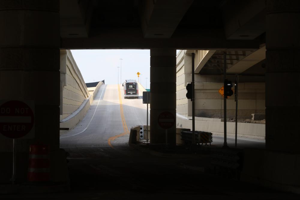
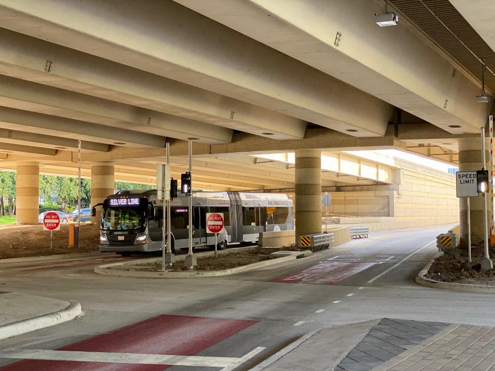
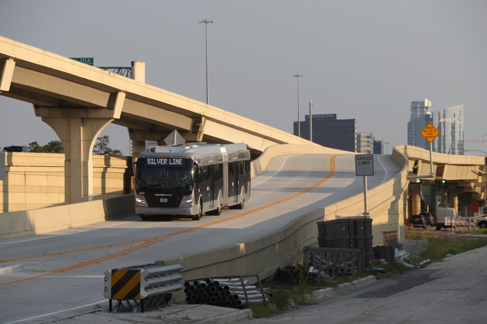
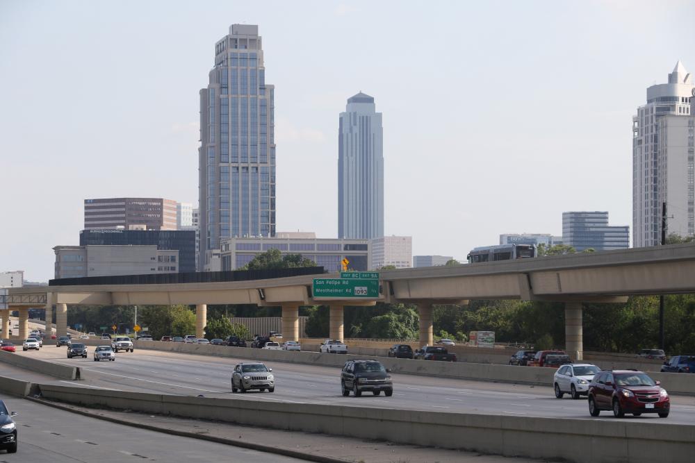
Freeways offer a great way to make fast transit. To get people from Greenspoint to Downtown or from Uptown to downtown, freeway BRT can cut travel time in half. On the Silver Line, dedicated bus lanes, built by TxDOT, start in the underpass where Post Oak crosses under 610, then rise up in the median of the freeway, cross the southbound lanes in a sinuous curve, follow the feeder road past Memorial Drive, and then land in the middle of North Post Oak. In form, it’s much like any other TxDOT structure, but in function it’s groundbreaking: These are bus-only lanes, not HOVs, guarded by gates that only let buses in. METRO is planning something similar along the Katy Freeway to connect the Silver Line to Downtown. Those same lanes could also carry regional express buses to suburban park-and-rides. Highway planners will say, of course, that those lanes can also carry carpools or single occupant vehicles. On IH45, TxDOT is proposing 4 “managed lanes” that could be used by buses, carpools, and likely longer distance express traffic, though they haven’t actually made a clear statement. But the City of Houston has requested that TxDOT look at transit-only lanes, which would be more reliable. The biggest downside to freeway transit is that it doesn’t do a good job of serving places along the way. A station within a freeway will always be harder to get to than a station on a city street, and will likely be more isolated, more dangerous, noisier, and less pleasant as a waiting location. Freeway alignments will make sense in some places, but a system that largely follows freeways will inevitably have low ridership.
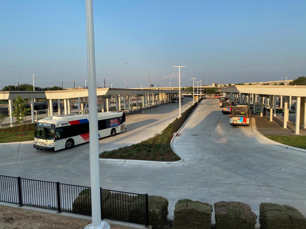
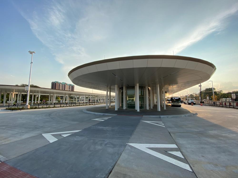
The other key component to BRT is connections. Some of these are simple: At Post Oak and Westheimer, the northbound and southbound Silver Line platforms are a short walk from local bus stops on the 82 route. Others are more elaborate. At the Silver Line’s north end, the new Northwest Transit Center connects thirteen local bus routes and park-and-rides on US290 and IH10. The reconstruction, managed by METRO and completed in time for the Silver Line opening, has created one of Houston’s best transit centers. It includes two long platforms with twenty bus bays and a standalone BRT platform, oriented for the future extension to Downtown. Raised “speed table” crosswalks create safe and wheelchair-friendly paths between the platforms, extended canopies overhang the buses so passengers can stay dry while boarding, landscaping flanks waiting areas, Bluetooth beacons and braille signs help the blind navigate, a staffed “ridestore” will provide customer service, and restrooms will be available for transit riders. This project—by HNTB, a multidisciplinary infrastructure firm—was one of the first trials of METRO’s new urban design program, and the design attention shows.
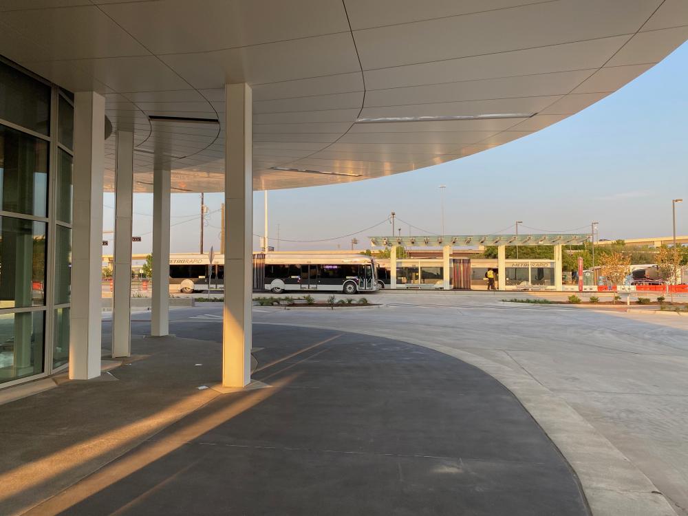
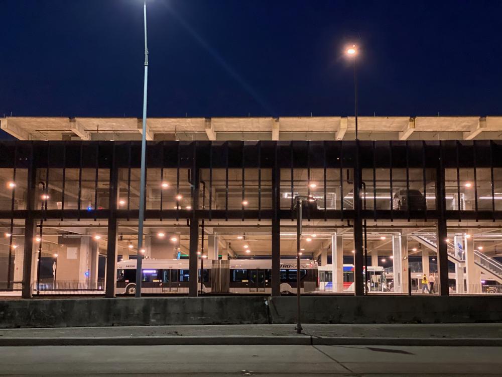
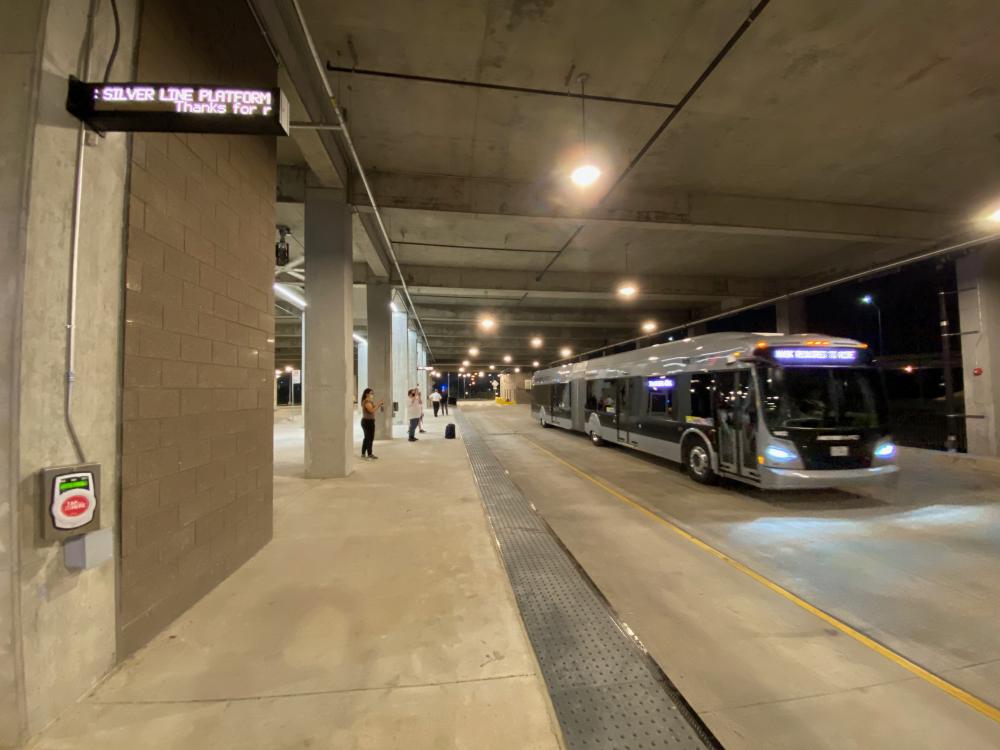
The same can’t be said at the Silver Line’s south end, where the brand new Westpark/Lower Uptown Transit Center, by Gunda Engineering, connects the Silver Line to Park and Ride buses on US59. It’s a totally new typology for Houston: Silver Line and local buses on the ground floor, parking on the second level, and park-and-rides on the roof, connected to the HOV lanes with a direct ramp. All three levels are linked vertically with a central stair and elevator core. The transfer between buses is entirely covered and separated from traffic. It’s obvious that the budget was spent on Post Oak: The transit center feels spartan. It’s basically a plain concrete parking garage. On opening day, there benches weren’t even installed. The site, chosen because it’s the only place where the HOV lane and Silver Line cross, is between Westpark Drive, the loading dock of a Microcenter big box, and isolated pocket of streets in the northern stretch of Bellaire. There’s no obvious pedestrian entrance, but even if there was, there aren’t (yet) any destinations nearby.
The realization of METRONext will bring more of these hubs, some improvements of existing transit centers and some new. If designed well, they can be convenient, pleasant places to wait for the next bus. But they can also be more: hubs for surrounding development, connections to greenways and walkable neighborhoods. These will be some of the spots in Houston—but will they be places, or will they be infrastructure? Creating great transit requires architects, landscape architects, and planners to be an integral part of project teams.
Among transit advocates, the biggest criticism of BRT is the idea of “BRT creep,” in which a project is proposed with a full set of features gets watered down over time. Through the process of planning and design, shelters might get smaller, bus lanes go away, ticket machines are replaced by fareboxes on the bus, and platforms are lowered to allow regular buses to use them. It’s usually a combination of political pressure and budget, and often the most important parts of BRT disappear where they’re needed most: It’s in crowded, congested places—where there is the most neighborhood resistance and the most construction complexity—where buses need their own lanes and stops need space for lots of passengers.
METRO and the Uptown District, though, held firm. The lanes on Post Oak are fully dedicated: Cars cross at intersections (with separate left turn lanes) but never enter the lanes. The elevated structure along the West Loop is only for buses. Every stop has a full shelter. Every platform uses level boarding. The only compromises are not having full signal priority at major cross streets—smaller cross streets will have it, though it’s not turned on yet—and awkward circulation in and out of the southern transit center. The specs are forward-thinking. The buses have doors on both sides so that platforms can be either in the middle or on the outside of the lanes; this will make it easier to build stations in a variety of places. The platform level also matches the light rail lines, so in the not-too-distance future, BRT vehicles may pull up to the same station platforms as Red, Green, or Purple Line trains, making for seamless transfers. METRO’s vision of BRT isn’t a compromise—it’s better than local bus service in almost every way.
But the real test of BRT is how it fits into the city. The Silver Line is a great transit line. It’s also an audacious vision of a different future—one in which Uptown, despite its origin as a car-oriented business zone, becomes a transit-centered, walkable place. BRT will serve many different places—some with walkable street grids, some without; some with string transit ridership today, some without; some where new development would be welcomed, and some where displacement and gentrification is a major concern. What does BRT mean for Montrose, Gulfton, Alief, the Third Ward, Greenspoint, Kashmere, or Westchase?
The future isn’t about the buses; the future is about where they get us.
Christof Spieler is a Vice President and Director of Planning at Huitt-Zollars, a Senior Lecturer in the Schools of Architecture and Engineering at Rice University, and the author of Trains, Buses, People: An Opinionated Atlas of US Transit (Island Press, 2018.) As a member of the METRO board from 2010 to 2018, he was involved in making the decision to build the Uptown line and he participated in early discussions of METRONext.


